Other platforms see a clearcut and call it deforestation. We see managed forestry — and prove it.
LandTrace is satellite-verified EUDR compliance for the US forest products sector — lumber, veneer, plywood, panels and more. Where generic tools run a single tree-cover-loss check and flag every harvest, LandTrace converges six cross-checks to separate managed silviculture from real deforestation.
Same signal as illegal clearing. Shipment held at customs.
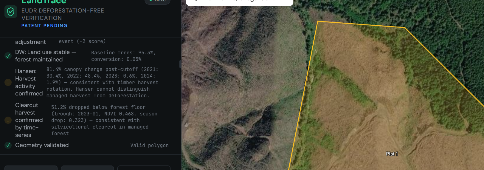
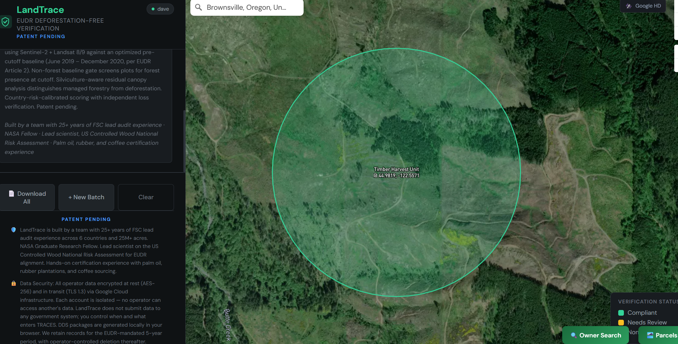
LCMS harvest · Dynamic World forest-use held · NDVI regenerating.
One tree-cover check fails on US timber.
Many EUDR platforms run a single tree-cover-loss check. On American working forests, that means a routine harvest can read exactly like illegal deforestation in the Amazon — even though the land stays forest and regrows.
A 40-acre clearcut in a managed forest returns the identical signal to permanent agricultural conversion. No distinction between a harvest that will regrow and forest that's gone for good.
The same cut, analysed across six datasets: LCMS confirms harvest disturbance, Dynamic World shows forest land use maintained, and the NDVI trajectory matches a harvest-regeneration cycle — with the primary-forest gate confirming it was never primary forest.
Six cross-checks, one defensible verdict.
No single signal can tell managed harvest from deforestation. LandTrace runs each plot through six cross-checks in-house — not an outsourced black box — and only clears it when the signals agree.
Vegetation change
Baseline vs. current NDVI, silviculture-aware — tells a regenerating harvest from permanent loss. Sentinel-2
Ground disturbance
NBR / NDBI change picks up skid trails, landings, and bare soil from harvest operations. Sentinel-2
Fire signature
dNBR burn detection separates fire-caused loss and salvage from anthropogenic clearing. Sentinel-2
Land-use transition
Dynamic World confirms forest land remains forest land — not converted to crop or built-up use.
Forest loss
Hansen Global Forest Change flags post-2020 canopy loss, year by year.
Time-series confirmation
The NDVI trough-and-recovery curve confirms a harvest-regeneration cycle. Sentinel-2
Backed by three gates: a non-forest baseline gate (forest presence at the cutoff), the GFT 2020 primary-forest gate, and the GFC 2020 cutoff baseline.
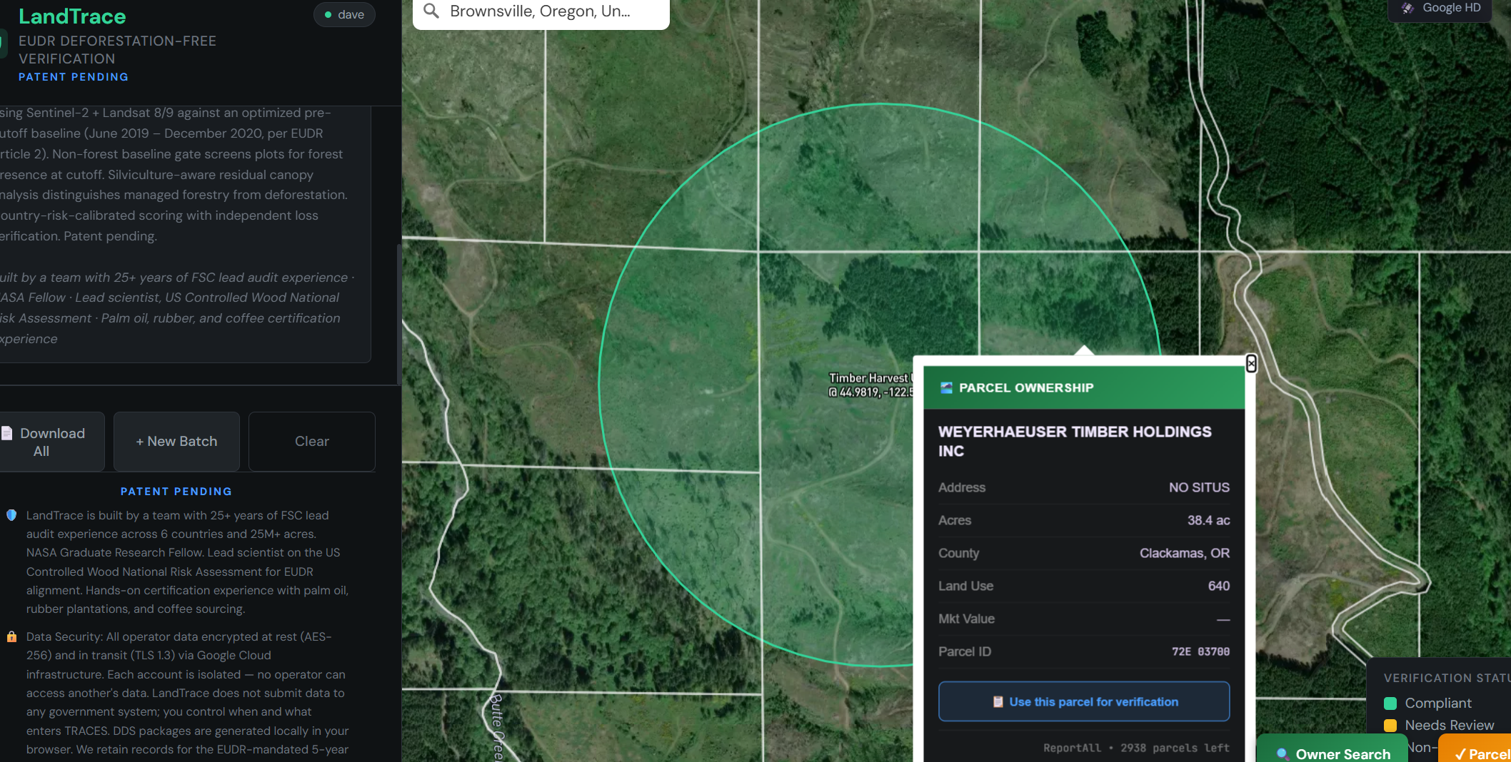
Built for the US forest products sector — at any scale.
If you place wood products on the EU market, EUDR reaches back to the harvest. LandTrace fits the way American forest products actually move, from a single mill to a multi-state operation.
Sawmills & lumber exporters
Dimensional softwood and hardwood lumber, siding, and trim shipped to EU buyers.
Veneer & plywood
Face veneer, plywood, and engineered wood where origin traces to specific harvest units.
Panels & particleboard
Wood-based panels (HS 4410–4411) drawing on mixed-source furnish across suppliers.
Secondary manufacturers
Furniture, flooring, and components needing a defensible DDS from their wood supply.
FSC-certified operations
Already have harvest units in GIS? LandTrace fills the satellite-verification gap FSC alone doesn't cover.
Mills running residues
Chips, sawdust, and by-products are a many-to-many traceability problem with its own approach.
See the residuals method →From a harvest unit to a customs-ready file.
Satellite verification report
Multi-sensor pass / warn / fail on every check, with the parcel on a satellite map and a full evidence PDF — every finding traced to its data source.
Guided DDS package
A 7-step wizard — operator, product, origin & geolocation, supply chain, legality, structured Article 10 risk assessment, review & generate.
TRACES-ready output
Complete DDS PDF with all Article 9 / Annex II fields plus a separate GeoJSON for geolocation upload — generated client-side, nothing submitted without you.
Annual monitoring (Art. 12)
Automated yearly re-check of verified parcels with change alerts, maintaining the EUDR-mandated 5-year record retention.
The map, the verdict, the evidence.
Draw or upload a parcel, run the verification on a satellite basemap, and walk away with a TRACES-ready file your EU buyer can rely on.
An EUDR forest platform that, unlike most, publishes its method.
Most EUDR tools are data-collection suites that license third-party remote sensing or run a single undisclosed check. LandTrace is built by a forester, with verification in-house.
Convergence, not a single layer
Six cross-checks agreeing — documented with source, method, and date range — not one outsourced score.
Silviculture-aware
A dedicated managed-harvest gate, so routine forestry clears instead of failing — far fewer false positives to chase.
Fire & salvage handling
FIRMS + LCMS separate wildfire and salvage from harvest and conversion — salvage from burned land is not deforestation.
Transparent & defensible
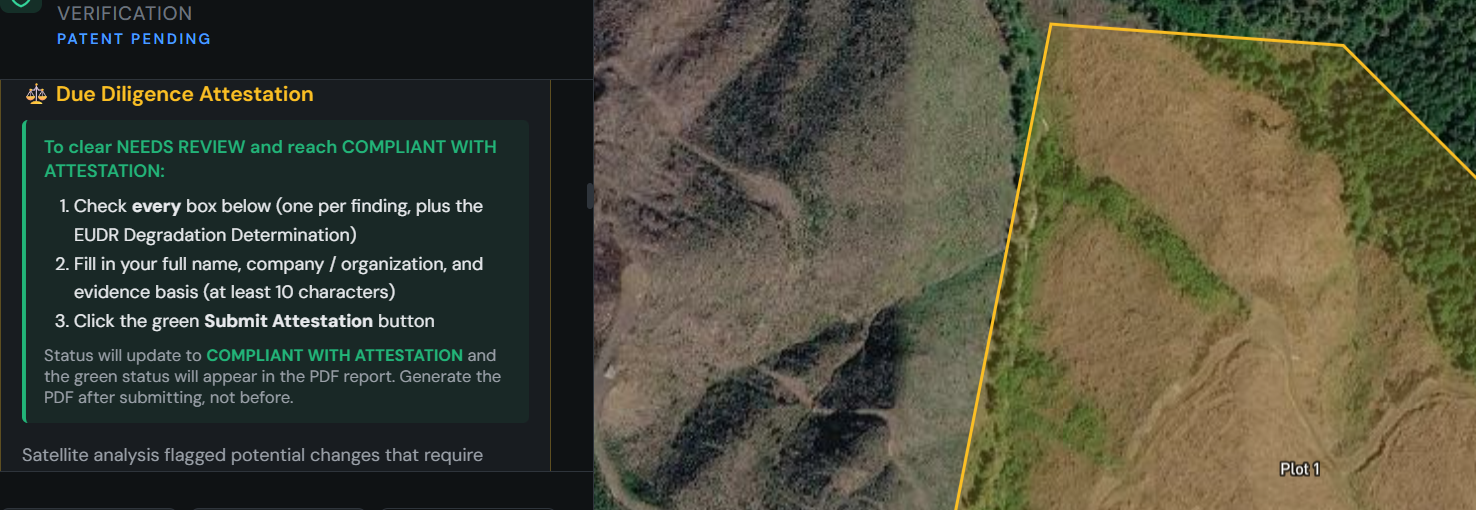
Public methodology and a full audit trail, built to be attested by a qualified forester and to withstand a substantiated-concern challenge.
Built by auditors, not a tech startup
Data security
- Operator data encrypted at rest (AES-256) and in transit (TLS 1.3) on Google Cloud
- Every account is isolated — no operator can access another's data
- DDS generated locally in your browser — nothing submitted to any government system without you
- Records retained for the EUDR-mandated 5 years, with operator-controlled deletion
Prefer it handled? A supply-chain risk assessment, end to end.
If you'd rather not run verifications yourself, our team delivers a documented, audit-ready Article 10 risk assessment of your entire sourcing basket — the same two-tier method, sized to your supply chain, billed hourly with no software fee.
Coarse basket-wide screen
Hansen Global Forest Change against the GFC 2020 forest baseline, ranked by GFT 2020 type — the whole basket resolves to green (managed / no loss) or red (conversion-candidate), with primary forest ranked first.
Targeted verification of the red
A statistically defensible sample of the red — primary forest first — runs through the silviculture-aware six-check Sentinel-2 pipeline at 10 m, classified green, yellow, or red per plot.
Documentary clearing
Yellow plots and red false positives — wildfire, salvage, permitted harvest — cleared against public harvest records (FERNS, FPARS, THP) and supplier attestation. Anything that can't be cleared is excluded or escalated.
Audit-ready deliverable
A written Article 10 risk report, the satellite evidence behind it, and a clear path to your DDS — delivered once, with optional annual monitoring to keep due diligence current.
Simple, honest pricing.
Start free, scale on a flat monthly rate, or have our team run the whole assessment for you — no per-parcel metering, no enterprise sales call.
Run three full verifications on your own harvest units — no account, no commitment. See exactly how LandTrace classifies your forest.
- Full six-check convergence analysis
- Satellite map with parcel boundary
- Evidence PDF for each verification
Everything, unlimited verifications, one price. Cancel anytime.
- Unlimited verifications across all your parcels
- 7-step DDS wizard + TRACES-ready output (PDF + GeoJSON)
- Supply-shed screening & permit reconciliation
- Annual Article 12 monitoring with change alerts
- Evidence PDFs with full audit trail
- 5-year record retention
Prefer it handled? Our team runs the full two-tier assessment — coarse screen, targeted sampling, permit clearing — and hands you an audit-ready DDS file.
- Expert-led risk assessment & verification
- Two-tier satellite screen + documentary clearing
- Billed hourly, sized to your basket's size & complexity
- No software, platform, or subscription fee
Software is a flat $175/month, unlimited verifications. Done-for-you assessments are billed hourly — no software fee.
Get EUDR-ready before December 2026.
Run a harvest unit you know well and watch the full verification — or start with three free verifications, no account required.